 vesseltracker.com
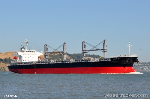
Vessel KING ISLAND IMO: 9537006, MMSI: 352006236 General Cargo
UTC, 32.69206, -117.85089, course: 160, speed: 11.5
UTC, 32.42372, -117.74175, course: 160, speed: 11.6
2026-03-10 08:28:04 UTC, 31.90323, -117.53240, course: 154, speed: 12
Live Vessel KING ISLAND Analytics (details, animations, etc.)
Live AIS position: UTC. 34 nm SW of Rosarito Terminal), updated 2026-03-10 08:28:04 UTC.Find the position of the vessel KING ISLAND on the map. The latter are known coordinates and path.
marine traffic ship tracker show on live map
The current position of vessel KING ISLAND is 31.90323 lat / -117.53240 lng. Updated: 2026-03-10 08:28:04 UTCCurrently sailing under the flag of Panama
Details:
Last coordinates of the vessel:
UTC, 33.04397, -117.99788, course: 157, speed: 11.9UTC, 32.69206, -117.85089, course: 160, speed: 11.5
UTC, 32.42372, -117.74175, course: 160, speed: 11.6
2026-03-10 08:28:04 UTC, 31.90323, -117.53240, course: 154, speed: 12